An alternative Fairfield Horseshoe 23.10.2016

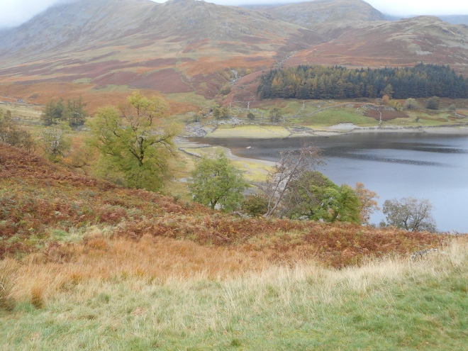
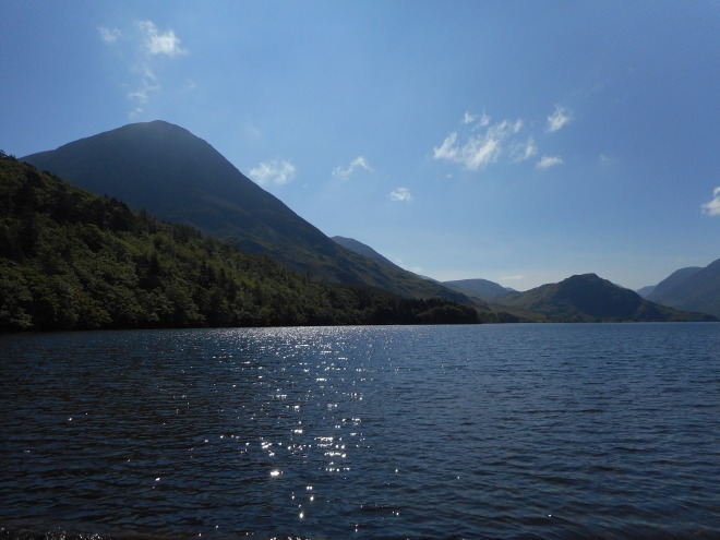
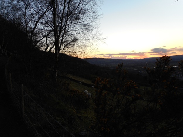
A chilling north-easterly wind was blowing as I left Cow Bridge and followed the shoreline path by Brotherswater. I had to move quickly, as I was only wearing a light fleece over my merino base layer, in anticipation of the steep climb to High Hartsop Dodd that I would shortly be facing. I still couldn’t resist an early photo though.

dscn1444

Middle Dodd and Red Screes, seen across Brotherswater

Passing Hartsop Hall, I was struck by the solidity of the stone pillars that held up one of the outbuildings. I love the traditional Lakeland farmhouses and find myself much more drawn to vernacular architecture than to the splendour of our great cathedrals or stately homes.

dscn1445

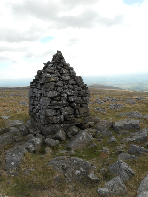
Dove Crag catching the sun

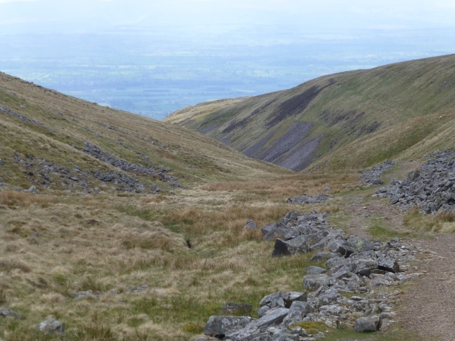
Within minutes, I had left the farmland behind and was tackling the relentlessly steep ascent to High Hartsop Dodd (1702 ft). As I expected, I soon felt very warm, despite the wind. Having said that, I needed an extra layer as soon as I reached the summit! The retrospective views were stunning and it was fascinating to observe the ever changing patterns of light and shade on the woodlands and hill slopes.

dscn1446

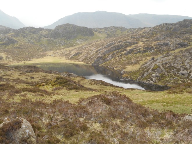
Looking back on Brotherswater, with Angletarn Pikes and Place Fell in the background

dscn1447

Patterns of light and shade on the slopes of Hartsop Above How

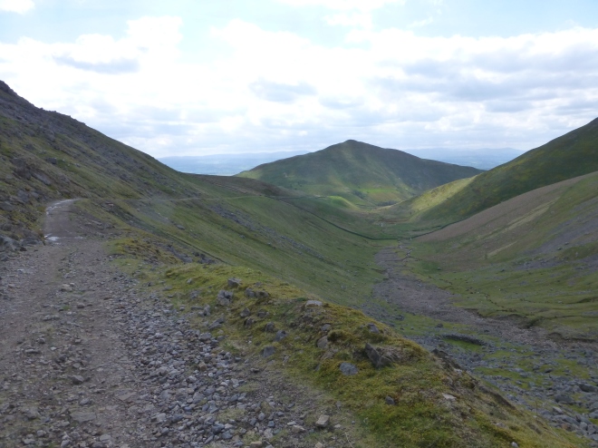
The onward ridge to Little Hart Crag (2090 ft) was a joy to tread and on reaching this next summit, I was able to see down into Scandale and towards Windermere. There were patches of sunlight here and there, and it was clear that the western half of the Lake District was enjoying better weather than the east.

dscn1448

The ridge heading to Little Hart Crag

dscn1449

Looking down on Scandale; a glimpse of Windermere in the background

dscn1450

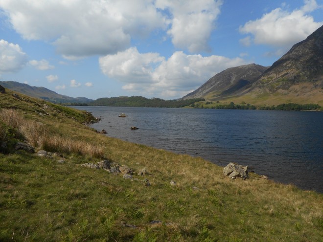
Another view of Brotherswater and Place Fell

The ascent to Dove Crag led me to the broader paths of the classic Fairfield Horseshoe route, which I planned to follow as far as Fairfield’s summit. I met a couple on the summit of Dove Crag (2598 ft) who planned to descend via the route I’d just come up, and they checked a couple of details with me before moving on. There was no let-up from the bitterly cold wind and so I pressed on towards Hart Crag (2698 ft). I could see that the mist was touching Fairfield’s summit, but I was confident that the wind would cause regular breaks in the cloud cover and allow me a view.

dscn1451

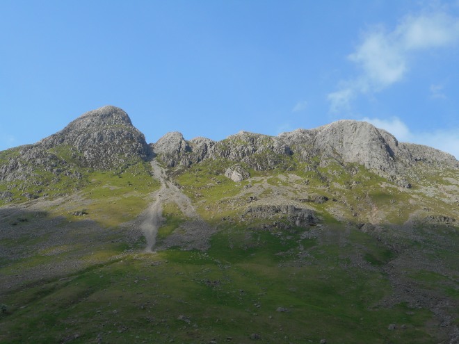
Zooming in on Great Gable and Dale Head

Approaching the summit of Fairfield (2863 ft), I found myself in the mist and was briefly dampened as a shower passed over. It didn’t last long though and as there was room at the summit shelter to sit in the lee of the wind, I decided to stop for an early lunch. This turned out to be a good decision as the cloud lifted almost as soon as I arrived, allowing more superb views across to Gable and the Scafells. They were bathed in golden sunshine, but I wasn’t jealous.

Leaving the summit, I was a little worried that the narrow ridge over Cofa Pike might be too exposed to the wind to cross safely.  Luckily this wasn’t the case, and I was soon climbing up to St Sunday Crag (2759 ft).  The sun was starting to shine by this point, so I was able to take my time and enjoy my surroundings a little more.

dscn1452

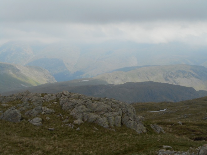
Looking north to Dollywaggon Pike, Nethermost Pike and Helvellyn

dscn1453

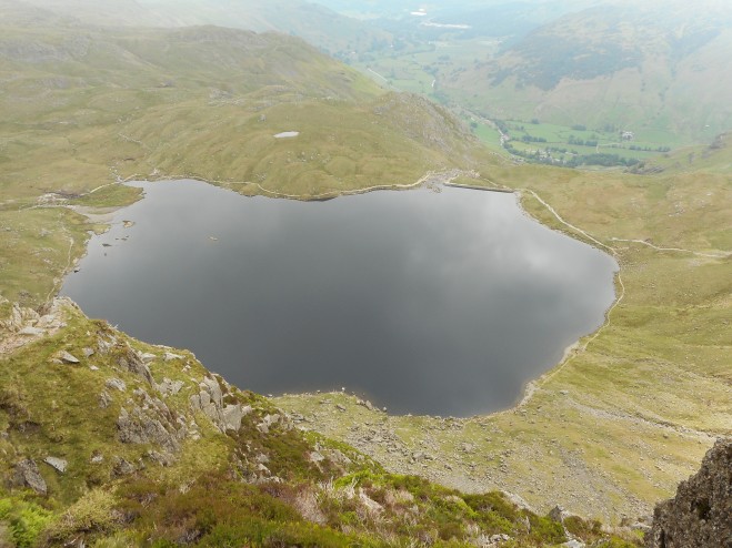
Grisedale Tarn and Seat Sandal, with the Scafells and Great Gable in the background

dscn1454

Another view towards Nethermost Pike and Helvellyn

Looking back towards Fairfield, I was particularly impressed by the tremendous prow of Greenhow End. It looked formidably steep from this angle, but apparently involves nothing more demanding than Grade 1 scrambling. I must return to explore it some time.

From St Sunday Crag, I dropped down to Gavel Pike and descended to Deepdale via the east ridge. I found an intermittent path in places, but it was obvious that this is not one of the more popular routes. It always amazes me just how many of these off the beaten track routes there are in the Lake District – yet how often I hear people describe the area as overcrowded!

dscn1455

Looking back up at Gavel Pike from the east ridge

dscn1456

Mosaic of farmland and woodland on the valley floor

dscn1457

Looking over to Rest Dodd and High Street

Reaching the valley floor, a simple stroll down a farm track and through delightful woodland returned me to my start point.

Mardale Horseshoe 22.10.2016

The lake level was surprisingly low when I arrived at Mardale Head, allowing glimpses of the old field boundaries leading to the village now submerged beneath the reservoir. I tried to imagine the valley as it would have looked before it was flooded, but found it hard to picture fields and farms where now there was only gently lapping water. The trees, bracken and even some of the moor grasses were a blaze of autumnal colour, lending a cheerful note to an otherwise sombre scene.

dscn1425

Looking up Mardale Beck towards Mardale Ill Bell (in the mist)

dscn1426

Some of the old field boundaries leading down into the waters

dscn1427

Looking up the ridge towards Rough Crag

dscn1428

More of the old field boundaries, with Kidsty Pike looming behind

We headed up towards High Street along the Rough Crag ridge, which to my mind is the most interesting and dramatic approach to an otherwise rather featureless mountain. As we gained height, the mist continually revealed and then concealed different parts of the skyline and small patches of sunlight briefly illuminated patches of hillside, before the gaps in the clouds closed once again. A brief gentle shower cooled us on one of the steeper sections but did not last long. From the summit of Rough Crag (2060 ft), revealing views down into Riggindale and towards Blea Water opened up, the surface of the latter showing very little disturbance from the wind.

dscn1429

Haweswater from Rough Crag

dscn1430

A sudden opening in the clouds above Harter Fell

Reaching the summit of High Street (2718 ft), the mist closed in once again and we started to feel the effect of the wind. Consequently, we didn’t linger. The day still being young, we decided to head over to Thornthwaite Crag (2572 ft) and as we did, we walked into clearer weather, with Windermere and Morecambe Bay both becoming visible. It seemed as though every man and his dog was at the summit, so after admiring the view of the Ill Bell ridge, we turned about face and took the path that contours around the head of Kentmere and towards Mardale Ill Bell (2493 ft). We were able to enjoy the view down into Kentmere before we were once again enveloped in mist as we neared Mardale Ill Bell.

dscn1433

Nan Bield Pass and Harter Fell from Mardale Ill Bell

dscn1434

Brightening weather as we descend to Nan Bield Pass.  The tarn in the centre of the picture is Small Water.

Happily the mist was only thin and we were able to pick out the onward route to Nan Bield without recourse to map or compass. Part way down, we decided to drop down the Kentmere flank to find shelter for lunch. As we sat eating, we were rewarded with a sighting of a trio of red deer hinds at the bottom of the slope. This being the rutting season, I had hoped to see or at least hear the stags, but it was not to be on this day.

dscn1436

Looking back at Mardale Ill Bell and Rough Crag from Harter Fell

Reaching the summit of Harter Fell (2552 ft), we found ourselves on more featureless terrain, but as the cloud level had lifted, we were able to enjoy far reaching views down into Longsleddale and across to the Pennines. We dropped down to Gatescarth Pass and just beyond encountered the only truly boggy section of the whole route. A wide detour was required to outflank it, but we were soon heading up drier ground towards Branstree (2339 ft). Looking back towards Harter Fell, I was surprised by the craggy aspect that it presents in this direction. More moorland terrain followed as we continued to Branstree North East Top (2208 ft) and Selside Pike (2149 ft), interest being provided by a well-constructed survey pillar (built in connection with the reservoir) and a small but attractive tarn. The oddly-named Captain Whelter Bog turned out to be much less wet than we had feared an in fact was far less of an obstacle than the nameless quagmire at Gatescarth pass.

As we descended towards the old corpse road, we were hit by the only truly wetting shower of the day. Thankfully this too was brief and didn’t require the dreaded overtrousers! I was looking forward to the old corpse road as its history has always fascinated me since I first learned of its existence. I was interested to see that it appears to have been roughly surfaced in places and that even though it must now be many years since it was last used for anything other than recreation, parts of the surface are still visible. Even more impressive to me was that the dalesfolk had carried coffins up such a steeply-graded path. They truly were made of tougher stuff in those times.

dscn1437

The head of Mardale from the Old Corpse Road

dscn1440

Autumnal colour above Rowantreethwaite Gill; Hopgill Beck beyond

dscn1441

The waterfall in Hopgill Beck

Just before the final descent to the lake, we encountered a cluster of what I took to be shielings, which enjoyed a stunning view of the valley. Relict woodlands in the two gills to our left provided further autumnal spectacle. Did the people who had lived up here during the summer months appreciate the beauty, we wondered? Given the sense of loss that displaced people often describe (particularly the victims of the Highland clearances, and the Irish emigrants), I thought that they must have done. As we dropped down the final slope, I was reminded of Wainwright’s words describing his first visit, which he made just before the lake was dammed, but after the village had been evacuated: ‘I thought I had never seen a more beautiful picture.  Nor a sadder one.’

dscn1443

Bridge at the bottom of the Old Corpse Road

Noss 22.06.2016

Noss is another of the places that for one reason or another, we’d been unable to visit on our first trip to Shetland.  We were determined that we wouldn’t miss out on seeing its spectacular cliff scenery and abundant bird life a second time.  Even reaching Noss is a bit of an adventure, requiring a ferry across to Bressay, followed by a three mile journey across that island to its wild eastern coastline.  An old track then leads down to a small jetty where a second ferry (just a RIB taking a few passengers at a time) crosses the narrow sound to land on Noss.

A full circuit of the island is only six miles, but I predicted at the outset (correctly as it turned out!) that we would nevertheless be rushing to make the last boat back.  It’s that kind of place.  Walking anti-clockwise seems to be the norm, presumably because the southern coast is slightly more interesting, and also because this direction gives a more dramatic build-up to the scenic highlight, the Noup of Noss.

4.Noss (2)

Rounding the delightfully named Stinking Geo, near the start of the circuit.  The Noup of Noss can be seen on the far right.

The route begins with fairly gentle walking on grass, above low cliffs.  As elsewhere in Shetland, we found the remains of crabs and sea urchins everywhere.  After rounding Stinking Geo, we began to gain height, and the cliff scenery became more dramatic.

IMG_0511

Tarristie of Setter

IMG_0512

A small natural arch

IMG_0515

The Point of Hovie, with its cave

IMG_0516

Looking back at the Point of Hovie, with Bressay in the background.  Sea pinks in abundance!

In some places, chasms are starting to open up as the cliff edges break away due to the constant pounding of the sea and the winter storms, so the temptation to go right to the edge had to be resisted!

IMG_0517

Feadda Ness

At Cradle Holm, a rockfall on the Noss side has caused the two islands to re-connect at low tide, though it must have been high tide on our visit as there was clear water between the two.

IMG_0518

Cradle Holm from the west

IMG_0521

4.3Noss (2)

Looking down the channel that once separated Cradle Holm from Noss, but now only does so at high tide

It was here that we encountered our first puffins, and a comical trio posed obligingly for the camera.

IMG_0529

The old dry stone walls also seem to be popular with the Shetland wrens (an endemic subspecies).

4.Shetland Wren

Shetland wren

As dramatic as Cradle Holm is, nothing quite prepares you for the spectacle of the Noup of Noss.  A towering prow of old red sandstone, it rises sheer from the sea to a height of 592 feet and is home to innumerable gannets, fulmars, shags, guillemots, kittiwakes, razorbills and black guillemots.

4.4Noss

Noup of Noss

Though not in fact the most numerous, it is the gannets that grab the attention most with their amazing diving antics. The ears are also bombarded by the din and the nose by the pungent aroma of guano.  I spent quite some time just enjoying the sensory overload.

DSCN1122

Gannets

4.1Noss

Seabird skyscraper!

The view from the summit is stunning for such a low altitude.  It is apparently sometimes possible to see Fair Isle away to the south, and Foula overtopping the lower hills of Mainland.  I tried, but couldn’t pick either of these out, though it was clear on our visit.

IMG_0543

The view across the island, with Bressay and Mainland in the background

IMG_0547

Looking back to the Noup

The northern side of the island doesn’t quite live up to the drama of the south.  Even so, there are plenty of headlands and geos to investigate.  I can never resist walking out to a headland, which is probably why we were able to take several hours over a six-mile walk!  As it was, we only made the last boat back with ten minutes to spare.  But after all, it would be criminal to rush around such a magical place.

IMG_0548IMG_0551IMG_0554

IMG_0557

A few images from the return leg

Some photos by Georgina Collins

Point of Fethaland 20.06 .2016

We’ve recently returned from a fortnight in Shetland, during which we were out exploring its fantastic coastline every day and amazingly, experiencing almost continuous good weather.  I don’t intend to write a post about every single day (because I’m too lazy), but hopefully this will be the first of three posts covering some of our most memorable days.

Fethaland is the northernmost tip of Mainland and somewhere that we hadn’t visited on our previous trip to Shetland.  Like everywhere in Shetland, the coastline here is a chaotic jumble of cliffs, headlands, inlets (geos), skerries, stacks, natural arches, sea lochs and caves.  Every twist and turn of the coast reveals another staggering view, or another headland that just has to be walked out to.  For this reason, even short walks in Shetland take hours.

Our plan was simple – we would set off from North Roe and keep the coast on our right till we reached the Point of Fethaland, whence a good track would return us to our start point.

DSCN1090

A couple of small geos near the start of the route

DSCN1095

Looking north – the coast of Yell can just be seen on the right

IMG_0479

Looking south across Burra Voe

IMG_0480

Looking right across the peninsula to the west coast

DSCN1097

Another of the many geos – Yell in the background

DSCN1098

Looking back south along our route

DSCN1099

Approaching the Head of Virdibreck

IMG_0481

Wick of Virdibreck

IMG_0484

Kame of Isbister – or as Karen called it, the Dragon’s Head

DSCN1100

Looking back at the Head of Virdibreck

IMG_0485

Another view of the Kame of Isbister and its natural arch

IMG_0486

…and another

IMG_0488

Looking north along the coast

DSCN1104

Trumba and Eislin Geo

IMG_0490

A closer view of Eislin Geo

IMG_0491

Our objective finally comes into view!

IMG_0492

The Isle of Fethaland – the northernmost point of the peninsula (though not actually an island)

IMG_0497

The rock architecture hereabouts was amazing

IMG_0498

You can really see why Shetland is so popular with geologists

DSCN1106

This geo isn’t maned on the map, but the headland has the wonderful name of Fluga Taing

DSCN1108

I wonder how far back that tunnel goes?

IMG_0500

Common seals (I think)

IMG_0502

Wick of Breibister

The Isle of Fethaland was the undoubted highlight of the walk.  The cliff scenery here is almost too spectacular to be true.  It must be an incredible sight when the winter gales bring the waves crashing in.

IMG_0503

Looking south-west from the north tip of the Isle

IMG_0504

Skerries off the northern tip

IMG_05053.Point of Fethaland

IMG_0506

The amazing cliff scenery on the west coast of the Isle

On the neck of land that connects the Isle of Fethaland to the rest of the peninsula are the remains of a haaf (deep sea) fishing station, which remained in use until the 20th century.  Amazing to think that somewhere that is so peaceful today was until relatively recently a hive of industry.

Point of Fethaland

Remains of the fishing station

Some photos by Georgina Collins.


Langdale Pikes via Jack’s Rake 04.06.2016

Although I’ve done a lot of hillwalking in the Lakes and am nearing completion of the Wainwrights, I’d never before done Jack’s Rake.  I got most of the way up one February day around ten years ago, but retreated below the top as I was concerned about the potential for ice.  A recent hut weekend in Chapel Stile with Burnley Mountaineering Club provided me with the perfect opportunity to put that right.

I left New Dungeon Ghyll at about 9 am and make rapid progress up Mill Gill, despite the warm and humid conditions, as I was keen to get the rake to myself if I could.  As I climbed, I encountered a large number of people descending, whose t-shirts declared them to be participants in the D of E Award Diamond Challenge.

DSCN1031

Cascades in Mill Gill

The water level in the gill was very low, and it did occur to me that it would have been quite possible to have done the scramble up the gill too.  Ah well, another time.

DSCN1032

Pavey Ark and Stickle Tarn

DSCN1033

A closer view of Pavey Ark = Jack’s Rake is the diagonal line that runs from bottom right to top left

The waters of Stickle Tarn were incredibly still with barely a ripple disturbing the surface.

DSCN1034

Stickle Tarn reflections

I didn’t hang around at the tarn, as there were two people just behind me and I didn’t want them to get to the rake before I did.  Not because I’m not a sharing person you understand, but there is some loose rock on Jack’s Rake, and I didn’t want any of it being sent down to me from above.  As it turned out, I needn’t have worried as they were climbers whose sights were obviously set on harder routes.

DSCN1035

Looking up from the bottom of Jack’s Rake

Reaching the bottom of the rake turned out to be the worst part of the day, as the path is now very loose.  I was glad of my poles for that part of the route, though of course I made sure to stow them securely for the ascent of the rake itself.

The ascent of Jack’s Rake (Grade 1, 500 ft of climbing) is fairly easy for the most part.  I did find that couple of the moves needed of a bit of thought, but that’s probably more of a reflection on my lack of condition than on the difficulty of the scramble.  For all that, I thought it was a fantastic route and would quite happily have done it all over again.

DSCN1037DSCN1038DSCN1039DSCN1040DSCN1041

DSCN1042

A few shots of and from the scramble

I had a quick breather on the summit of Pavey Ark (2300 ft), before heading first for Sergeant Man (2414 ft), then Codale Head (2395 ft) and High Raise (2500 ft).

DSCN1043

Harrison Stickle from Pavey Ark

DSCN1044

Looking down to Stickle Tarn and Great Langdale

DSCN1045

The distinctive summit of Sergeant Man

DSCN1046

Another glimpse of Stickle Tarn, from Sergeant Man

DSCN1047

Zooming in on Grasmere

DSCN1049

Steel Fell and the mist-shrouded Helvellyn range from the unfrequented top of Codale Head

DSCN1050

Sergeant Man from Codale Head

I stopped for lunch on the summit of High Raise, before pressing on for perhaps the least-distinguished summit of the day, Thunacar Knott (2372 ft).  It does possess a nice tarn though.

DSCN1054

Tarn on Thunacar Knott

DSCN1055

Harrison Stickle from Thunacar Knott

After walking in relative solitude for most of the day, it was a bit of a shock to the system to find the summit of Harrison Stickle thronged with people.  Who could blame them though?

DSCN1056

Stickle Tarn from Harrison Stickle

DSCN1058

A shaft of sunlight highlighting Jack’s Rake

As the day was still young, I decided to visit the other two Langdale Pikes, Loft Crag (2231 ft) and Pike o’ Stickle (2326 ft).  I was surprised by how few people seemed to bother with the former; I spent quite a while on the summit and had it to myself the whole time.

DSCN1059

Loft Crag

DSCN1060

Looking back at Harrison Stickle from Thorn Crag

DSCN1062

Side Pike and Blea Tran from Loft Crag

DSCN1063

Approaching Pike o’ Stickle

Pike o’ Stickle must be one of the best summits in the Lakes.  Not only is it the perfect shape, but you can’t get to the top without using hands as well as feet.  It’s certainly one of my favourites.

DSCN1064

Harrison Stickle from Pike o’ Stickle

Leaving Pike o’ Stickle, I headed across the featureless expanse of Martcrag Moor.  I took special care as the previous time I’d walked across there, I tripped and sprained my ankle, which made my descent to the valley excruciatingly painful.  Luckily, there were no mishaps this time.

DSCN1065

Retrospective view of Pike o’ Stickle

Reaching Stake Pass, I decided I still had time and energy for one last top, so headed for Rossett Pike (2136 ft).  Earlier in the day, I had even entertained ideas of heading up Bowfell too, but the heat and humidity had taken their toll on my energy levels and I decided that this would be too much.

DSCN1066

Looking down Langdale from Rossett PIke

DSCN1068

Bowfell’s Great Slab from Rossett Pike

Leaving Rossett Pike, I couldn’t resist a quick peek at Angle Tarn, in my view one of the most beautiful spots in the Lakes.  I must camp out on its shores some day.

DSCN1069

Angle Tarn

I suppressed a shudder as I looked down at the old path that used to run straight down Rossett Gill.  A steep, endlessly shifting river of scree, it must have been one of the least pleasurable of Lake District paths to walk.  Thankfully, the old packhorse route nearby was brought back into use some years ago and makes for a much more forgiving descent.

DSCN1070

Mickleden from the head of Rossett Gill

DSCN1071

Looking back at Pike o’ Stickle from the descent

DSCN1072

A closer view of Pike o’ Stickle

As I trekked back along Mickleden, my weariness was alleviated slightly by a group of buzzards riding the thermals far above me.  What a magnificent sight these birds are – even though they are pretty common these days, I never tire of watching them.

DSCN1073

Pike o’ Stickle and Loft Crag from Mickleden

As so often seems to be the case, I enjoyed the best weather of the day as I walked the last couple of miles.  A good reason to do more wild camping, I suppose.

DSCN1074

The view down Great Langdale as I neared the New Dungeon Ghyll

Mellbreak 30.05.2016


Mellbreak (1680 ft) is a hill that I’d been intending to climb for a long time, but somehow had never got around too, mainly I think because it’s fairly isolated from other hills and so doesn’t really make for a full day out.  However, the prospect of another warm and sunny day meant that a relatively moderate walk was just what we were looking for.

DSCN0996

Lanthwaite Wood

We started from Lanthwaite Wood, near the foot of Crummock Water.  It was wonderfully cool in the woodland, and the sun was creating beautiful patterns of light and shade through the trees.  Every now and then, gaps in the trees allowed us tantalising glimpses of Mellbreak across the beck.

DSCN0998

Mellbreak seen across the beck

Emerging onto the lake shore, we enjoyed the fabulous views down the Buttermere valley, before striking out across farm pastures to the foot of Mellbreak.  This section of the route was quite fiddly as the route of the path across the farmland wasn’t entirely obvious.  As usual, I found that I needed the map far more in the valley than I did on the tops.

DSCN0999

Grasmoor and Rannerdale Knotts seen across Crummock Water

DSCN1002

Heading across the farmland towards the foot of Mellbreak

DSCN1003

Low Fell

Above Highpark farm, more lovely woodlands led us to the base of the hill.  There were many small dragonflies hereabouts, but as they didn’t land for long enough for us ever to photograph one, we were unable to identify them.

DSCN1004

Looking across to Whiteside and Grasmoor from the start of the ascent

DSCN1005

Starting the ascent

DSCN1006

Looking back on Loweswater

The climb up to Mellbreak’s north top is every bit as steep as it looks from below, but thankfully, the breeze increased rapidly as we gained height.  Less welcome were the midges that we found in the more sheltered spots.  We found the loose scree rather tiresome, but it didn’t go on for too long before we were back among rock and heather.  Once established on the eastern edge, there were stunning views down to Crummock Water, by this time well below us, and further down the valley towards Buttermere.

DSCN1007

Looking down on Loweswater and Low Fell

DSCN1009

Crummock Water and Buttermere

There were quite a few people about on the north top, though most of them seemed only to be doing this one, and not continuing to the higher south top.  The intervening ground between the two is not at all what you would expect from below – an undulating heathery plateau, with various boggy hollows, much more reminiscent of the Pennines than the Lakes.  The views in all directions are superb however, thanks to the Mellbreak’s precipitous sides.

DSCN1010

Whiteside and Grasmoor from the north top

DSCN1015

The main summit from the north top

DSCN1016

Mosedale with Starling Dodd behind

I had to agree with the general consensus that the south top is inferior to the north in terms of both views and character.  As though aware of its failings, it manages only a feeble summit cairn, though there is a better one a few feet lower down, which also happens to have better views than the summit.

DSCN1019

Crummock Water and Buttermere from near the main summit

DSCN1020

Hen Comb from below the summit

DSCN1023

Looking towards Red Pike

A steep but rapid descent brought us to the beck that flows from Scale Force, which we had visited two days previously.  As it was still only fairly early, we decided to make a detour to Buttermere for ice cream.  Walking back along the shores of Crummock Water, I was struck by just how much wilder the western side of the lake is than the east.  Here we were still very much in mountain terrain, with the slopes of Mellbreak soaring directly above us, complete with crags, heather and bogs, while on the other side of the lake was the road to Buttermere and lush green farm pastures.

DSCN1024

Descending towards Crummock Water

DSCN1026

Looking back at Mellbreak


DSCN1028

Low Ling Crag jutting out into Crummock Water

DSCN1030

Crummock Water lake shore

This was a fantastic walk and I was glad that we hadn’t left Mellbreak for a bad weather day, or a quick half-day, as is often the case with the lower hills.

Fleetwith Pike, Haystacks and High Stile 28.05.2016

We were keen to get going as early as possible for the punishingly steep ascent of Fleetwith Edge, but even though we left Gatesgarth at 8.30 am (OK, I know it’s not very early, but the hostel didn’t serve breakfast till 7.30), the sun was already high in the sky.  Luckily one or two of the steeper sections were still in the shade, but we were still pretty warm by the time we arrived at the summit of Fleetwith Pike (2126 ft).  At least the heat gave us a good excuse for regular stops to take in the view – and what a view it is.  This must be one of the finest routes up any mountain in the Lakes.

DSCN0929

The view to Buttermere, shortly after leaving Gatesgarth

DSCN0930

Haystacks from the ascent route

DSCN0932

Pausing for breath on the ascent – the haze was already starting to build up

DSCN0934

Buttermere from the summit cairn

While admiring the view from the summit cairn, Georgina spotted a ring ouzel nearby.  Given that I’d only seen my first one two weeks previously, I was pretty pleased to see another one so soon.  I was even happier when another two came to join it!

DSCN0939

Ring ouzel (photo by Georgina Collins)

We were soon joined on the summit by a chap who asked us if we’d seen anybody wearing a red sash – the first of several people to ask us this question.  I gather that they were participants in the Lakes Hunt, a cross between hide-and-seek and tag for grown-ups.  We never saw any of the ‘hares’ (the people who wear the red sashes and who are pursued by the ‘hunters’), but we were to hear their horns several times throughout the day.

Beyond Fleetwith Pike, I made a detour to visit the summit of Honister Crag (2077 ft), a Nuttall summit that was only ‘discovered’ fairly recently – too recently to feature in the book, in any case.

DSCN0942

Fleetwith Pike and Buttermere from Honister Crag

Heading now for Haystacks, we dropped down to pass Dubs Hut, one of the few MBA bothies in the Lakes.  It seemed that there was a work party in for the weekend, though they were out when we arrived.  It was impressively clean and well maintained, so if any members of the work party read this, thanks guys!

DSCN0943

Dubs Hut with Haystacks behind

DSCN0944

The spotless interior of Dubs Hut – the loungers were labelled as MBA property, so I guess you normally have to sleep on the stone bench or the floor

DSCN0945

The entrance to the bothy

The climb up to Haystacks was a delight; nowhere steep, but a succession of heathery hummocks, small crags and infant becks.  It’s easy to see why it was Wainwright’s favourite.

DSCN0946

Admiring the view back to Fleetwith Pike from one of the many knolls

DSCN0948

Another view of Buttermere

The path also passes a couple of delightful tarns, both of which would make idyllic camping spots.  Innominate Tarn is of course famous as Wainwright’s final resting place, but I thought Blackbeck Tarn was just as attractive.  No doubt it is less popular too!

DSCN0949

Blackbeck Tarn.  The increasing haze made photography difficult.

DSCN0950

Innominate Tarn

We stopped for lunch on the summit of Haystacks (1958 ft), which also boasts a lovely tarn.  It also gave us chance to boost our energy levels for the second big climb of the day, from Scarth Gap to the summit of High Crag.

DSCN0953

High Crag from the summit of Haystacks

DSCN0956

Pillar from Scarth Gap

The ascent of Gamlin End wasn’t as bad as it looked from below, though it was unpleasantly loose at the top.  Still, somebody has done an amazing job of repairing the lower two thirds of the route.

DSCN0957

Heading up Gamlin End

The summit of High Crag (2441 ft) is the beginning of the fabulous High Stile ridge, a lofty promenade that offers vertiginous views down into Burtness Comb, with Buttermere below.

DSCN0961

Buttermere seen below Burtness Comb

The ridge leading to High Stile gave us great views of Grey Crag, home to some classic climbs.  That we only saw one pair of climbers on the crag on a warm and dry bank holiday weekend I think speaks volumes about current trends in climbing – increasingly, traditional mountain crags are seemingly being abandoned in favour of sport climing, bouldering and indoor walls.

DSCN0962

Climbers on Grey Crag (photo by Georgina Collins)

DSCN0963

Looking back along the ridge to High Crag from the summit of High Stile

DSCN0964

Bleaberry Tarn and Buttermere from High Stile

High Stile (2631 ft) is the literal and metaphorical high point of the ridge, with stunning views down into Buttermere and Bleaberry Comb.

DSCN0966

Bleaberry Comb and Tarn from the ridge leading to Red Pike

DSCN0967

Looking back to High Stile

Our final summit of the day was Red Pike (2477 ft), an accurate if unimaginative name for the peak.  It’s another stunning viewpoint, and one that we were lucky to have to ourselves for a few minutes.

DSCN0970

Looking down to Buttermere from Red Pike, with the Robinson – Dale Head ridge in the background

We didn’t fancy the look of the horribly loose and eroded path leading down to Bleaberry Tarn, so opted for the longer but more forgiving descent via Scale Force.  This is perhaps a less dramatic route, but it is quiet and does give good views towards Mellbreak and Crummock Water.

DSCN0971

Looking towards Lingcomb Edge, our descent route, from the summit

DSCN0972

Crummock Water from the end of Lingcomb Edge

DSCN0974

Red Pike from Lingcomb Edge

The highlight of our descent route was Scale Force.  This was a popular spot with Victorian tourists, and still seems pretty popular today.  Today’s tourists have to walk though, unlike the Victorians, who were ferried across the lake in boats to the foot of the waterfall.

DSCN0975

Scale Force

DSCN0977

Fleetwith Pike seen across Buttermere from our return route to the village.  Our ascent route was via the edge in the centre of this photo. 

The return to Gatesgarth via the lakeshore was a beautiful walk, as always, and I was lucky enough to see a family of goosander enjoying an evening swim.

DSCN0978

Goosander family

Luckily the haze that had been so prevalent for much of the day began to shift as evening began, allowing me to enjoy probably the clearest view of Fleetwith Pike I’d seen all day, a beautiful end to a fabulous day.

DSCN0979

Fleetwith Pike from Gatesgarth

Some photos by Georgina Collins

High Cup Nick 15.05.2016

For the second day of our weekend in Dufton, we decided to visit the spectacular High Cup Nick, with a return over the moorland summit of Backstone Edge.  First however, we wanted to wander through Dufton Gill to see the bluebells in sunlight.  Having wandered through the woods on the Friday evening, we knew it was a sight worth seeing.  They really were beautiful.  And there are so many – possibly the most I have ever seen in one place.  Annoyingly I found that my camera battery had died, but luckily Andrew’s was in full working order.  All of the pictures in this post were therefore taken by him.

Leaving the wood, we took a farm path that would take us almost to the bottom of High Cup Gill.  Most people follow the Pennine Way from Dufton village, but a relative had tipped us off that a more dramatic approach was to take the footpath that climbs right up through the bottom of the gill, exiting steeply at High Cup Nick itself.

P1080468

The sunlight starts to break through onto to side of the gill

P1080470

Looking back out of High Cup Gill

High Cup Gill is sometimes claimed as ‘England’s Grand Canyon’ and though it has to be said that this is something of an exaggeration, it’s probably true to say that it is England’s finest example of a glacial valley.  As height is gained and the sides of the valley start to converge, it does become slightly claustrophobic – but truly magnificent.

P1080471P1080472P1080474P1080475P1080476

P1080477

The slot on the left of this photo is the ‘Nick’ – a name that is often wrongly applied to the whole valley

The spectacular ring of crags that encircles the whole valley is part of the Whin Sill, an intrusion of dolerite (known locally as whinstone) that runs right through the northern Pennines, and forms such distinctive features as Cauldron Snout and High Force, as well as the Farne Islands and the outcrops on which Lindisfarne and Bamburgh Castles are built.  The highest section of Hardian’s Wall also runs across crags formed by the Whin Sill.

P1080478P1080479P1080482P1080483

The climb out from the head of the gill was extremely steep, but this provided a good excuse to admire the view frequently.  Although there was a path throughout, it can’t be very well used as of the 30 or so people that we must have seen at High Cup Nick, not one had used our route through the gill, nor did anybody appear to be returning that way.

P1080485

This is the view looking down from the nick itself

Once we’d eaten lunch and satisfied ourselves that we had spent enough time admiring the view, we left the crowds behind to head up on to Backstone Edge.

P1080486

Climbing up towards Backstone Edge

On reaching the moorland above, I was pleasantly surprised to find that a footpath had come into being since my previous visit around ten years ago.  On that occasion, we’d had to wade through the ankle-deep heather, an energy-sapping experience that had worn the dog out and almost made us miss our train home.  This may have been before the implementation of the ‘right to roam’, which would perhaps explain why there were fewer people walking there at that time.

P1080490

The author by the large cairn at Narrowgate Beacon.  The onward route followed the edge of the moor round to the right.

P1080491

P1080493

A last look back at High Cup Nick from Narrowgate Beacon

The path continued all the way to the summit of Backstone Edge (2293 ft); not really a summit at all, just a high point in a sea of rolling moorland.  The path seemed to run out beyond the summit, but by that time Great Rundale Tarn, our next objective, had come into view.  Oddly, although the tarn is named after Great Rundale, its outflow doesn’t feed that valley, but instead runs east, to join the Tees.

P1080494

Great Rundale Tarn

Beyond the tarn, we followed an old mine track down into Great Rundale.  It was rather loose and stony, but made for a quick descent.

P1080496

Heading down into Great Rundale

P1080498

The lower reaches of Great Rundale.  The structure on the left is an old lime kiln.

P1080501

Dufton Pike comes into view at the end of Great Rundale

Reaching the bottom of the valley with time and energy to spare, we decided to nip up Dufton Pike as it was such a nice day.

P1080502

Cuckoo flowers on the track below Dufton Pike

P1080503

Looking to Knock Pike and distant Cross Fell from below Dufton Pike

P1080504

Zooming in on Cross Fell

Once the track that runs across the base of Dufton Pike is left, the ascent becomes very steep, though it’s grassy all the way.

P1080505

Looking across the sunlight-dappled Eden valley to the Lakeland fells from the ascent

P1080506

Looking to Cross Fell and the Dun Fells from our ascent route

The views from the summit (1578 ft) are magnificent; more so than those from higher nearby fells.  This is mainly due to Dufton Pike’s pointed shape, which contrasts with the rolling moorland more prevalent in these parts.  The difference in shape is due to the underlying geology – Dufton Pike is formed from Borrowdale volcanic rock, more commonly found in the Lake District.

P1080507

Backstone Edge from the summit.  The track in the centre-left was our descent route from the former.

P1080508

The view to the south.  The prominent peak is Murton Pike – High Cup Gill is immediately to its left.

A steep descent returned us to the old mine track and back to Dufton.  It had been a superb walk, made all the more so by the sheer variety of the scenery encountered, which proved if nothing else that there is much more to the Pennines than the ‘dreary moorland’ of popular repute.

All photos by Andrew Collins.


Cross Fell 14.05.2016

My brother Andrew and I were spending the weekend at Dufton Youth Hostel, and having woken up to a glorious morning on the Saturday, decided that Cross Fell would make a suitable objective.  Monarch of the Pennines, at 2930 ft, Cross Fell is one of the ten highest mountains in England (though in which position depends upon how you define a mountain – a debate I don’t intend to enter into here!), and is higher than Lakeland giants Pillar, Fairfield and Blencathra.  The last two of these are clearly in view from Cross Fell’s summit on a clear day.  We had planned a route that would take us from the tiny village of Kirkland via and old mine track to the Pennine Way, which we would then follow over the Dun Fells and Knock Fell back to Dufton.

DSCN0887

Looking back down Kirkland Beck

DSCN0888

The old mine track heading for Ardale

DSCN0889

Kirkland Beck

DSCN0890

Cocklock Scar

DSCN0892

Looking towards Black Doors at the head of Ardale

DSCN0895

A closer view of the Black Doors

The mine track made for a very easy and gentle ascent, with excellent views into neighbouring Ardale.  It’s a much easier climb than many much lower Lakeland fells, though also much longer.

DSCN0896

Cross Fell’s summit dome comes into view

Shortly after parting company with the mine track, we came across a bothy at the side of the path.  It’s obviously been around for some time as it’s marked on the map, though what it could be used for, I found it hard to imagine.  There isn’t room to sleep inside and there is barely room to sit up.  Perhaps it was a place where coffins were rested when this track was used as a corpse road.

DSCN0897

The bothy at 674348

Rather than tackle the screes surrounding the summit dome, we continued to the junction with the Pennine Way, joining the latter for the remainder of our walk.  As we climbed towards the summit, we could see a couple of small patches of snow stubbornly clinging on in hollows on the northern slopes of the mountain.

DSCN0898

Looking northwards towards Cold Fell.  The tiny bright green speck on the right of the picture is a mountain biker.

DSCN0899

Looking towards Alston from near the summit

DSCN0900

A currick defending the summit plateau

We reached the summit just in time for lunch, which was handy as it would have been a shame to pass up on the opportunity to use the recently rebuilt wind shelter.  Unusually for a mountain famed for its winds, it was very still; almost silent at times.  Before sitting down, we had a wander across to the far side of the plateau.  On the way, we encountered a dunlin, which stood unmoving only a few feet away from us.  We thought it was probably trying to lead us away from its nest, so we made sure to tread very carefully to avoid standing on any eggs.

P1080428

Dunlin (Photo by Andrew Collins)

DSCN0904

Wind shelter and trig point on the summit

Whilst eating lunch in the summit wind shelter, we were joined by two gents whose large backpacks and conversation suggested that they were doing the Pennine Way.  In fact we were to encounter several other people who also appeared to be doing this.  I was slightly surprised, as I thought the Pennine Way had declined in popularity in recent years, though I guess this will be peak time of year for people to attempt it.

Though there is an extensive view of the Lakeland fells from the summit, I didn’t take any photos in that direction as it was a little hazy.

P1080431

Little Dun Fell (with the cloud shadow passing over) and Great Dun Fell (with the radar dome) from a currick on the south side of the summit plateau.  The hill in the background is Mickle Fell, highest in Yorkshire.  (Photo by Andrew Collins)

From Cross Fell, we continued along the Pennine Way to Little Dun Fell (2762 ft) and Great Dun Fell (2782 ft).  Thanks to the radar dome on its summit, Great Dun Fell must be one of the most distinctive if also most unattractive summits in England.  Still, I’d take this over a wind farm any day (scenically speaking).  I was surprised that it is possible to enter and wander around the radar dome compound – perhaps someone in NATS management is a keen peak bagger?

DSCN0909

Looking east from Little Dun Fell across the featureless Pennine moorland

P1080436

Looking back at The Screes on Cross Fell.  The red colour presumably indicates the presence or iron ore.  (Picture by Andrew Collins)

DSCN0910

Looking back to Little Dun Fell and Cross Fell from Great Dun Fell

DSCN0911

Knock Fell and Mickle Fell from Great Dun Fell

Just below the summit of Great Dun Fell, the path drops down into a particularly good example of a hush.  These were created by lead miners by damming becks and then releasing the water once a large amount had built up, so as to remove the upper layers of vegetation and soil and thus (hopefully) reveal the lead ore below.  There are many examples dotted about the Pennines and although they are a bit of a blot on the landscape, they are fascinating relics of the industrial heritage of the area.

DSCN0912

Dunfell Hush

On the climb up towards Knock Fell, I noticed a small area of limestone, complete with mini limestone pavement and a little further beyond, a tiny pothole.  A quick bit of research on ukcaving.com suggests that this is probably an entrance into the extensive Knock Fell Caverns.

DSCN0913

Limestone pavement on Knock Fell

DSCN0914

The small pothole

The limestone can’t be very extensive at surface level hereabouts, as we were soon back onto the boggy ground more typical of the higher Pennines.  There are even a few small tarns dotted about in the vicinity.

DSCN0915

Tarn near the summit of Knock Fell

DSCN0916

Boulder field with the imaginatively named Round Hill in the background

P1080440

Looking back at Cross Fell and Great Dun Fell from Knock Fell (Picture by Andrew Collins)

The summit of Knock Fell (2605 ft) is not particularly inspiring and even the summit cairn is a poor effort when compared with the nearby currick Knock Old Man.  The views are good though.

DSCN0917

Knock Old Man

The descent from Knock Fell seemed long, but it was gentle and there was an attractive beck for company.  This eventually joins Swindale, which forms an impressive gill in its lower reaches.

DSCN0919

Looking down into Swindale

DSCN0920

Another view of Swindale

Just after I had taken the photo above, I saw a ring ouzel flying low across the bed of the gill.  I wasn’t close enough to identify it visually (or to photograph it), but was its distinctive call gave it away.  Unfortunately it went into hiding, so I didn’t get a second look.

DSCN0921

Knock Pike from Swindale

DSCN0923

Dufton Pike

The walk back along the valley bottom was very pleasant, with good views of Dufton Pike.  As we passed Halsteads Farm, unbeknownst to us, a sheep was being driven into the lane just as we were about the pass the gateway leading from its field.  On running into the lane and seeing us, it did an about turn and within no time at all was back at the far end of the field!  No doubt the farmer and the sheepdog were cursing our unfortunate timing.  Happily the remainder of the walk back to Dufton passed without incident.

DSCN0926

Primroses growing by the side of the track we followed back to Dufton

DSCN0927

Another view of Dufton Pike

From Your Front Door: The Chevin 25.04.2016

When I received an email from Zoe at Outdoor Bloggers requesting posts on the theme of ‘From Your Front Door’, I knew exactly where I had to write about.  My home town, Otley is dominated by The Chevin, which is really the first of the Pennine hills as you travel up the valley of the Wharfe.  The name is thought to derive from the Celtic word cefn, which features unchanged in the Welsh language to this day, and means ridge.  Nowadays, The Chevin is a Forest Park, and is well-loved by local people.  I recently headed out one evening after work to explore it anew for this post.

The most popular route up The Chevin is via the Victorian steps that climb straight up to Surprise View from Otley’s old railway station.  It’s a good route, but it is a very steep climb and you do miss out the western end of the ridge.  I prefer to use the paths that climb up from West Chevin Road, or as on this occasion, Sinclair Field.

DSCN0836

Great Dib from Sinclar’s Field


DSCN0839

The path climbs along an escarpment through the trees

DSCN0841

Almscliffe Crag seen across the valley

DSCN0842

Great Dib – the steep slope here is the result of a post-glacial landslip

I headed from Great Dip up onto the highest parts of The Chevin.  The summit itself isn’t particularly exciting and I didn’t visit it on this occasion.  Far more impressive is nearby Surprise View (925 ft), which most people believe to be the summit anyway.  This stands in an area of open moorland, well above the woods.

DSCN0843

Open moorland near Surprise View

DSCN0844

The gritstone outcrop at Surprise View

DSCN0845

The person in this shot is standing on the highest of the rocks at Surprise View

DSCN0846

Looking north-west up Wharfedale.  Round Hill is the furthest hill in view.

DSCN0847

Looking east from Surprise View.  In exceptionally clear weather, the white horse at Kilburn in the North York Moors can be seen.

From Surprise View, I headed along Miller Lane to the Danefield Estate, the lower and more densely wooded eastern half of The Chevin.

DSCN0852

The sun was nicely catching this birch in Cleaver Wood

As I climbed up to Deer Park Plantation, a red kite flew just above the tops of the trees; a beautiful sight with the sun lighting up the underside of the body.  However, I wasn’t quick enough with the camera to get a photo.

DSCN0853

Deer Park Plantation

The highest part of the Danefield Estate is crowned by a trig point, which must have had an extensive view when it was first erected.  It now stands forlornly in a fire break between Deer Park and Memorial Plantations.

DSCN0854

The lonely trig point

The red kite came back to taunt me as I was standing by the trig point, this time making sure that it was just high enough in the sky to make a poor photograph.

DSCN0855

Path junction at Flint Wood.  You could go for a different walk every day for a week or more on The Chevin, there are so many paths.

I headed down through Quarry Wood towards Caley Deer Park, passing the only wetland area on the hill as I went.

DSCN0856

Wetland area above Caley Deer Park

DSCN0857

Part of the old deer park

J. M. W. Turner used to stay at Farnley Hall on the other side of the valley.  The Hall was the seat of the Fawkes family, who owned the Danefield Estate at that time, and it was whilst staying with the family that Turner was inspired by a thunderstorm passing over The Chevin to paint Hannibal Crossing the Alps.  Turner would also later paint the crags themselves.

DSCN0858

Looking across to Washburndale from above Caley Deer Park

DSCN0861

Knotford Nook and the entrance to Washburndale from the ‘Turner viewpoint’, as I call it

From the deer park I headed back west, passing the Main Crag en route.  Though popular with climbers, there weren’t any about on this occasion.

DSCN0862

Caley Crags

DSCN0863

Another View of the crag

Beyond the crags, I headed through Poolscar Wood and soon found myself at one of my favourite spots on The Chevin, the bridge over the Holbeck.  One day I intend to walk the full length of this beck, keeping as close to the water as I can.

DSCN0864

Looking up the Holbeck…

DSCN0865

…And looking down

Foxscar Wood is home to the remains of an Iron-Age settlement, though it has to be admitted that a very good imagination is required to reconstruct it.

DSCN0866

The site of the Iron-Age settlement

Danefield Wood, the westernmost of the plantations on the Danefield Estate, puts on a great display of bluebells in May.  I noticed that they were just starting to come out as I passed and made a mental note to return in a week or two.

The Chevin had one final treat in store for me – as I crossed East Chevin Road, I was witness to the most glorious sunset.  I’ll leave you with a few pictures of it – which show far better than my words can why you shouldn’t dismiss what you can find from your front door.

DSCN0867DSCN0868DSCN0869DSCN0870